
.
Winsley on Maps
Winsley, Bradford on Av0n, Wiltshire
.
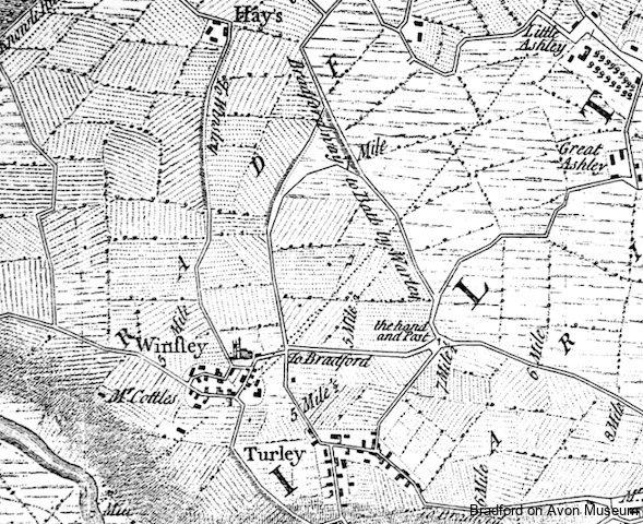
Part of Thomas Thorpe’s 1742 map of 5 miles around the City of Bath
. .
.
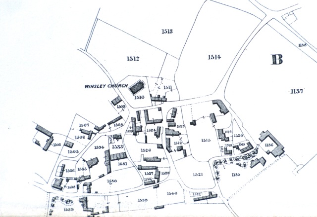
An extract from the Tithe Apportionment survey of the parish of Bradford made by the Bristol surveyor George Culley Ashmead and published in 1841. The numbers refer to the list of properties. The layout of the roads and of houses seems to make no sense at all and the church is on the edge of the settlement rather than at its centre.
.
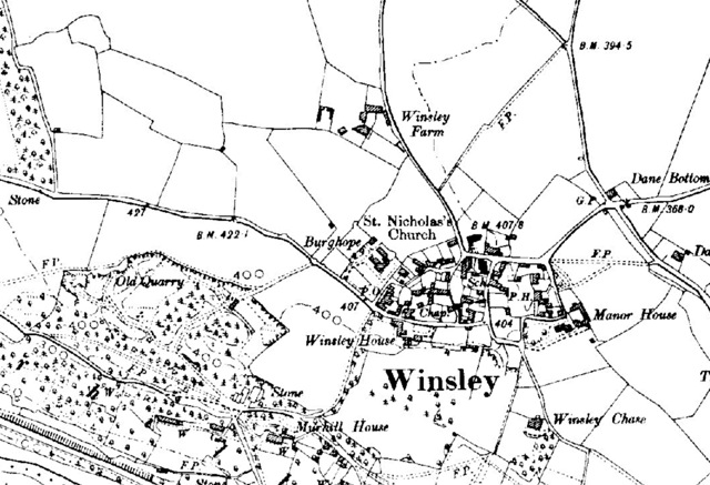
The Ordnance Survey 6-inch map of 1900 shows Winsley as still a compact village with a few outlying farms and houses. Very little had changed in the 60 years since the Tithe Map. The extensive quarries at the top of Murhill to the west were by then disused and overgrown, but the Winsley Sanatorium was soon to be built there. Winsley Farm is now called Church Farm.
.
.
.
.
.

Winsley village today (OpenStreetMaps contributors)