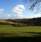
Rob’s Field Walk, Saturday 26th October 2013
The weather was kind to us as we set off from St Lawrence School armed with plots of the LIDAR survey. We passed near the site of the Roman villa and were soon looking at our first ancient field which showed up as three sides of a rectangle, only one of which marries up with a tithe boundary. Our next point of interest was a possible Iron Age enclosure – a curvilinear boundary, preserved in a curve of the road and continuing on the LIDAR plot.
The Thresher map of 1727 shows what looks like ridge and furrow in this field but sadly no trace of it was visible on the LIDAR plot. In the arable fields the plot continued to reveal linear features which have survived despite intensive cultivation, and we examined pieces of pottery revealed by recent rain. We ended our walk in parkland, now paddocks, where changes in level of the modern fences could be seen to match the LIDAR data. The detail revealed by LIDAR is staggering and will be invaluable in unravelling the development of the landscape.
Click the image for a larger version
See the results!
An exhibition setting out the results of our Heritage Lottery funded historic landscape project will be on show in the Library Meeting Room from 23rd November – 2nd December during Library opening hours.
Get involved!
There are many ways to get involved with the project: looking at aerial photographs, field walking, helping to plot the findings on maps, to name but a few. For those interested in helping with the project, we will also be running training sessions on identifying earthworks, and other skills.
If you are interested in getting involved with this exciting project, please contact Roy Canham on 01225 866748 or at roycanham@btinternet.com.
If you’re not sure what you could do to help, read our How To Get Involved blog post.
If you aren’t able to help, but you want to keep up to date, then please follow our blog. We’ll be holding public talks and other events throughout the year, so look out for announcements here.


