Roy’s woodland survey

Get involved!

If you are interested in getting involved with this exciting project, please contact Roy Canham on 01225 866748 or at roycanham@btinternet.com.
If you’re not sure what you could do to help, read our How To Get Involved blog post.
If you aren’t able to help, but you want to keep up to date, then please follow our blog. We’ll be holding public talks and other events later in the year, so look out for announcements here.
Ancient Landscapes of the Bradford Hundred
Our second Community Dig of 2014 begins Monday 11th August, and we will update the Ancient Landscapes pages during the dig.
Read our Community Dig blog from Spring 2014.
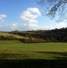
Ancient Landscapes of the Bradford Hundred started as a Heritage Lottery funded Museum project in 2013, using ground-breaking LIDAR technology to survey an area of 12 square km stretching from the town towards Winsley and Monkton Farleigh.
Read more about the 2013 project in the blog, or in our publication A Land Through Time.

Recent Posts
Lidar exhibition moves to Chippenham
Museum Booklet: A Land Through Time
This is not the end, and watch the video!