Kate’s Field Checking Story
In order to help with interpreting the LIDAR survey results, it is important to know the state of each field at the time of the survey.
Our LIDAR flight took place on Friday 11th January, but within a few days the whole area was covered by snow making it impossible to conduct a survey of the state of each field. However, Roy had divided the 12 square km area into zones, and as soon as the snow began to clear, the field checking team went into action.
Armed with a pen, a map, a camera, and a large packet of wine gums, and wearing some sturdy walking boots to avoid slipping in the mud on the steep bits, Mandy and I ventured out on Saturday 26th January to check what was in each field in Winsley Zone 4. It was a cold day, but Winsley Zone 4 provided a nice walk as we plotted the most efficient way to get around all of the fields on our map. There was still a bit of snow about, and it took us about 2.5hrs in all, longer than we’d expected, and we just about made it back before it got dark.
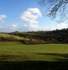
At each field we stopped, took a photograph of the field, noted the photograph number on the map, and the point and direction of the photograph, and filled in the check sheet, selecting the most appropriate description (Pasture; Winter Wheat / Barley; Kale; Plough Soil; Other), noting the height of any grass / crops, and checking for livestock (Cattle; Sheep; Horses; Other), with the most notable ‘Other’ on our walk being 3 alpacas. We also had to note any Hay / Straw Bales or Heaps Manure / Silage although I didn’t see any in Winsley Zone 4.
On Sunday 27th January I set out again, this time with Giles, to check Turleigh Zone 2. Sunday was a much brighter day, and all traces of snow had disappeared – it was even warm enough to take our coats off. Turleigh Zone 2 is an area I don’t know well at all, and we had a lovely walk (albeit stopping every few minutes to photograph and document fields). Taking photographs as well as writing on the check sheet turned out to be very worthwhile, as although I didn’t spot any Archaeology myself, Roy spotted some in some of my photographs.
All in all, I felt very virtuous for my two country walks in one weekend, and I’m pleased to have contributed something to this exciting project too.
Get involved!
There are many ways to get involved with the project: looking at aerial photographs, field walking, helping to plot the findings on maps, to name but a few. For those interested in helping with the project, we will also be running training sessions on reading aerial photographs, identifying earthworks, and other skills.
If you are interested in getting involved with this exciting project, please contact Roy Canham on 01225 866748 or at roycanham@btinternet.com.
If you aren’t able to help, but you want to keep up to date, then please follow our blog. We’ll be holding public talks and other events later in the year, so look out for announcements here.


